Transform Geospatial Data Into Decisions
Turn complex geospatial data into clear, actionable insights — empowering stakeholders to make informed decisions and engage communities through interactive 3D visualizations.
Features
Comprehensive suite of specialized tools for geospatial analysis and visualization
AI-Enhanced Rendering
Transform 3D map views into stunning, marketing-ready photorealistic visualizations.
Designed for Everyone
Modern, intuitive interface for mobile and desktop users.
Storytelling
Craft compelling narratives with your geospatial data with presentation tools.
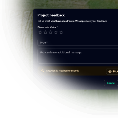
Stakeholder Feedback
Gather stakeholder feedback directly within the context of your 3D maps.
Immersive experiences
Game-like Walkthroughs and 360 Panoramas offer stakeholders a lightweight, first-person navigation experience.
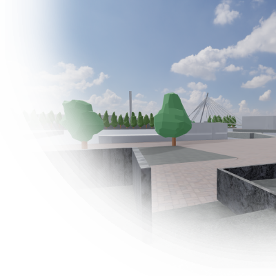
Hybrid 2D/3D Visualization
Seamlessly switch between 2D and 3D views of your geospatial data.
Viewshed Analysis
Determine visible areas from any point in your 3D scene.
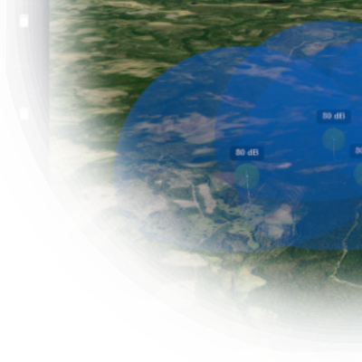
Noise Visualization
Reveal the hidden soundscape of your 3D environment. Visualize noise in easy-to-understand way.
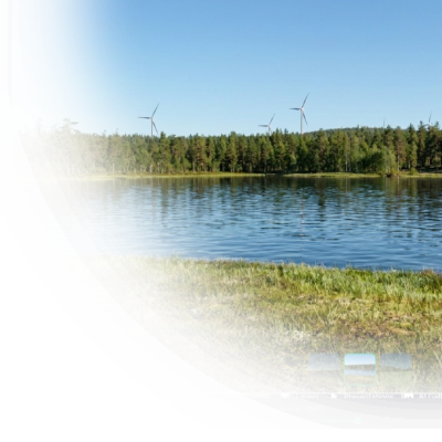
Wind Turbines
Deploy realistic wind turbines with animated rotors for stunning presentations.
Powerline Modeling
Bring powerlines to life with realistic sag and configurable pole types.
Editing and Management
Orchestrate your entire geospatial ecosystem from a single, intuitive interface.
Cloud Storage and Processing
Store, manage and share your data securely in the cloud.
Measurement Tools
Essential tools for planning and evaluating geospatial projects.
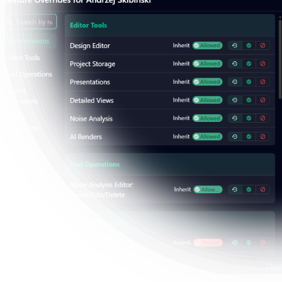
Organizational Governance
RBAC (role-based access control), defense-in-depth and data isolation designed to protect sensitive geospatial assets.
Public Sharing and Collaboration
Easily share your projects with stakeholders and the public with flexible access controls.
Custom Tools
Specialized analysis modules built for specific industry domains
5G Propagation Analysis
Blare.Tech 5G propagation modeling integrated for accurate telecom network planning and optimization.
Parking Camera Analysis
Planning and analysis of parking camera placements for smart city applications.
How It Works
Three simple steps to transform your geospatial workflow
Upload Your Data
Import BIM models, GIS datasets, and 3D assets into your project workspace. Or use our base data to get started instantly.
Explore & Analyze
Craft 2D/3D visualizations, run simulations, and create interactive presentations to uncover insights and communicate your vision.
Share & Collaborate
Invite stakeholders to view and interact with your projects in real-time, fostering collaboration and informed decision-making across teams.
Built for Professionals
Vistra combines cutting-edge 3D visualization technology with practical analysis tools to deliver a complete GIS solution for modern urban challenges.
Browser-based platform — no installation, no infrastructure to maintain
Unified 2D/3D visualization powered by Cesium with high-performance BIM/GIS rendering
AI-enhanced rendering and specialized analysis tools for telecom, noise, and urban planning
Modern and responsive interface designed for both technical and non-technical users
Transparent SaaS pricing with no upfront costs — scale from small projects to enterprise
Simple, Transparent Pricing
Choose the plan that fits your project scale.
Monthly subscription based on project size. All plans include the full feature set.
No upfront cost, no infrastructure to maintain.
All plans include:
2D/3D Visualization
Presentations
Security and role-based permissions
Object management and filtering
Optional public access and sharing
Technical support
Monthly
Annual
Small
Perfect for small projects, like architectural proposals or local planning initiatives
Storage
5GB
Size
up to 100 km²
Presentations
1
Model views
1
Pricing
250€
/ month
Medium
Ideal medium-sized projects, renewable energy proposals, infrastructure development or telecom network design
Storage
20GB
Size
up to 1000 km²
Presentations
3
Model views
3
Pricing
500€
/ month
Large
Best for large-scale projects, such as city-wide planning, smart city development, or regional infrastructure analysis
Storage
50GB
Size
Global
Presentations
10
Model views
10
Pricing
800€
/ month
Enterprise
For organizations needing multiple projects, custom features, or dedicated support. Contact us for a proposal.
Storage
Custom
Size
Global
Presentations
Unlimited
Model views
Unlimited
Need more storage for your data?
Fast, secure, and reliable hosting for your geospatial assets.
€5 / month
for 10GB of storage
Enterprise Options
For organizations with advanced needs, Vistra offers tailored enterprise solutions:
Data Processing
Leverage our deep expertise in geospatial data refinement. From BIM models and LiDAR scans to massive terrain datasets, we specialize in high-fidelity processing and optimization to deliver performant, web-ready 3D environments.
Whitelabel Deployment
Deploy Vistra Map with your branding and domain. Fully customizable UI and integrated into your ecosystem.
SaaS, White-label, or On-Prem Deployment
Deploy on your own infrastructure with on-premises, private cloud, or fully managed environment options.
Tools & Integrations
Extend the platform with bespoke analysis tools, data connectors, or workflow automations. Our team can deliver features tailored to your unique requirements.
SLA Guarantees
We ensure three nines (99.9% uptime), priority support, and rapid incident response with our service-level agreements designed for enterprise reliability.
Custom Analytics
Gain deeper insights with tailored analytics solutions. Get access to custom dashboards, usage reports, and data visualizations that help you understand user behavior and optimize your deployment.
Ready to Get Started?
Experience the full power of Vistra Map's 3D GIS capabilities.
Contact us for a personalized demo.